I got this route from an excellent website for Snowdon just here. I completed this route in Whitsun 2009 and found it particularly enjoyable, if a little tiring...! It's very up-and-down, but a very quiet route and quite interesting. You take in Moel Eilio, Foel Gron, Moel Cyngorion and finally Snowdon. The path starts in Llanberis, so you can descend by the Llanberis path rather than retracing your steps. It's a good idea to have a map and compass with you on this walk, as sometimes it can be a little unclear.
You start this route by what was formerly the Spar in Llanberis, but is no longer. It is not the current convenience store, but slightly past this on the left. Ask in the current shop (Londis when I was there) and they'll point you in the right direction. Turn left and head up the road towards the youth hostel. Eventually, you'll reach a track across the top, on which you should turn right.
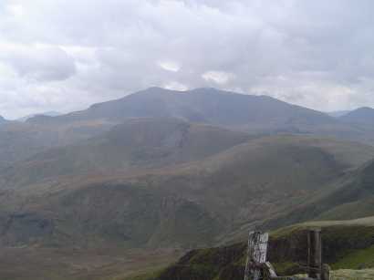
I particularly liked the next part of the walk, as I continued through rough pasture with sheep, gorse, and the odd boulder here and there. Eventually, you'll cross a small stream and meet another road, onto which you'll turn left. On your right, you'll see an old iron age fort. The road will become a track, and up to your left, you'll see a grassy slope on your left towards the grassy South Ridge of Moel Eilio. According to the Hightrek website, there's the remains of an old Marconi transmitter beacon here, but I was unable to find this. Across the valley past Llanberis, you'll see the remains of the old Dinorwig slate quarry. From the top of the ridge, you can actually see your route, over various peaks, to the summit of Snowdon. This should give you a good idea of the direction in which to head.
The next section takes you to Foel Goch, which you'll find by simply keeping the cliff edge on your right hand side. Follow this track up and down, and you'll reach Bwlch Maesgwm, where you'll cross a very well-defined bridle way. Don't be mislead by an earlier fairly-well-defined path - you'll know when you reach the right one.
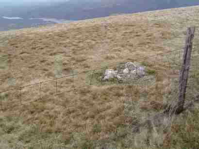
Continue North East, and leave the well-defined paths. Ascend a slope keeping next to the wire fence to the summit of Moel Cynghorion. The summit is a very small cairn of stones just over the fence, which can take some finding.
Turn right, and descend steeply to Llyn Ffynon y Gwas lake. The lake you can see as you descend is not the correct one - this is the large lake in the valley by the car park for the Snowdon Ranger path. I gave myself quite a shock when I thought I had to walk all the way down there and back up!
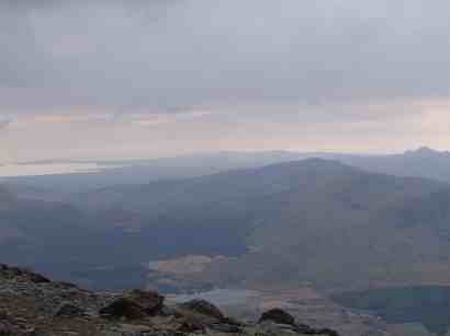
You don't actually go to the lake you're aiming for - it's on the opposite side of the Snowdon Ranger path. You'll join this on a bend, and turn left to zigzag up the rest of Snowdon. At the top, you'll join the Llanberis path, which will be your descent route. Cross the railway and follow the path to the summit!