Ben Nevis, although hard work, is one of my favourite mountains. It always feels like a vindaloo to me - you forget how hard it is until the next time you go up in the same way as a vindaloo never seems so hot the next day! I've now climbed the tourist route of Ben Nevis 3 times (at time of writing) so next time I'll try something a little more adventurous.
Ben Nevis is the highest peak in the British Isles, but when you're at ground level in Fort William, it appears much lower than it is, due to its domed summit and that it is on the coast. Even beginning the walk it seems easy, but I always find myself asking descenders "how far now", hearing the reply, mentally dividing by 3 and being surprised when the person who told me turns out to have been right! It's a long walk, and whilst the first half is beautiful, once you pass the grass line it can become very unpleasant in most weather conditions. Scotland is not known for its sunshine, and last time we were there, it rained every day for a week and my poor MG Maestro's sunroof leaked all over my headlining. And my wife!
It is important to remember that Ben Nevis can be a seious mountain in any weather, but particularly if it's not good. However warm it is at ground level, it's likely to be close to zero on the summit (unlike Snowdon, which can be quite pleasant for much of the year). It is also likely to be wet, as walking through clouds tends to be. Last time I went, there was a report at the bottom of an experienced hiker who'd died there the previous Christmas.
Anyway, how to do it. Start at the Glenn Nevis Visitors' Centre car park. Driving through Fort William with the loch on your left, you'll turn right at a roundabout by Morrison's, then left, and follow the signs. Park there, and go into the centre. There will be people there who can advise on weather conditions further up. Buy some water and food if you don't have any. Walking boots are a big advantage (although I did it in trainers aged 9, as did my sister aged 6).
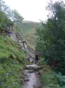
Leaving the car park at the back, you cross a stream via a bridge, then turn right to follow the footpath up the lower slopes. It's a pretty path, varying between rock-strewn grass and light tree cover, with a number of streams to step over. The views at this level are beautiful.
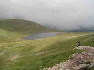
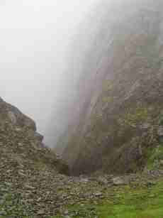
As you continue on, you'll go left around the edge of the foothill on which you're walking, then up a long-ish rock-strewn pathway with a stream down in the valley to your right. Keep on until the path bears round to the right onto "Ben Nevis proper", and there is a large lake in front of you. Make this most of it, as this is where the nice bit ends. From here it's a path through desolate rock and scree with little visibility (unless you're very lucky) until the top. You can't see the summit even on a clear day due to the shape of the mountain, so you just have to keep on. It feels like you're nearly there, but... you're not!
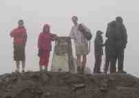
From this point, simply follow the crowds. The way becomes less distinct as you approach the summit, but is marked by substantial cairns. The summit is interesting, with a memorial, some old buildings, and a shelter about 20' off the ground, presumably to keep it above snow level in winter!
The descent is simply a matter of retracing your steps. However, don't miss one of my favourite views anyway if it's a misty day... that's when you come down out of the mist and it suddenly clears. In the right weather, the sudden image of the sun reflecting off the surface of the Loch Linnhe is breathtaking!